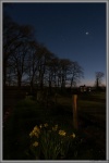
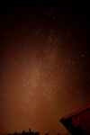
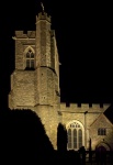
Neil Grantham - Milky Way over Bicester


You must login to enter a comment
Show IPTC dataHide IPTC data
| Creation date | 20200914 |
| 2#060 | 225702 |
| 2#062 | 20200914 |
| 2#063 | 225702 |
| Photographer | Neil Grantham |
| City | Bicester |
| State | England |
| Country | United Kingdom |
| 2#116 | © Neil Grantham |
Show EXIF dataHide EXIF data
| Make | NIKON CORPORATION |
| Model | NIKON D5300 |
| XResolution | 72 |
| YResolution | 72 |
| ResolutionUnit | inches |
| Software | Adobe Photoshop Lightroom Classic 10.1.1 (Windows) |
| ModifyDate | 2021:02:17 08:53:13 |
| Artist | Neil Grantham |
| Copyright | © Neil Grantham |
| ExposureTime | 20 s. |
| FNumber | f/3.5 |
| ExifOffset | 296 |
| ExposureProgram | Manual |
| GPSInfo | 994 |
| ISO | 3200 |
| SensitivityType | Recommended Exposure Index |
| ExifVersion | 0231 |
| DateTimeOriginal | 2020:09:14 22:57:02 |
| CreateDate | 2020:09:14 22:57:02 |
| OffsetTime | +00:00 |
| ShutterSpeedValue | -4.3 |
| ApertureValue | 3.6 |
| ExposureCompensation | 0.00 EV |
| MaxApertureValue | 3.6 |
| MeteringMode | Multi-segment |
| LightSource | Cloudy weather |
| Flash | No Flash |
| FocalLength | 18 mm. |
| SubSecTimeOriginal | 60 |
| SubSecTimeDigitized | 60 |
| ColorSpace | sRGB |
| FocalPlaneXResolution | 2559 |
| FocalPlaneYResolution | 2559 |
| FocalPlaneResolutionUnit | centimetres |
| SensingMethod | One-chip colour area sensor |
| FileSource | reserved |
| SceneType | |
| CFAPattern | |
| CustomRendered | Normal |
| ExposureMode | Manual exposure |
| WhiteBalance | Manual white balance |
| DigitalZoomRatio | 1/1 |
| FocalLengthIn35mmFormat | 27 mm. |
| SceneCaptureType | Standard |
| GainControl | High gain up |
| Contrast | Normal |
| Saturation | Normal |
| Sharpness | Normal |
| SubjectDistanceRange | unknown |
| SerialNumber | 6909720 |
| LensInfo | 180/10, 550/10, 35/10, 56/10 |
| LensModel | 18.0-55.0 mm f/3.5-5.6 |
| FileName | phpjA5rZK |
| FileDateTime | 19/02/2021 2:13 pm |
| FileSize | 114498 Bytes |
| FileType | jpg |
| MimeType | image/jpeg |
| SectionsFound | ANY_TAG, IFD0, THUMBNAIL, EXIF, GPS |
| GPSLatitudeRef | North |
| GPSLatitude | 51°54.7015'0" |
| GPSLongitudeRef | West |
| GPSLongitude | 1°9.2236'0" |
| GPSAltitudeRef | Above Sea Level |
| GPSAltitude | 87.00 |
| GPSTimeStamp | 21:57:23.35 |
| GPSSatellites | 05 |
| GPSMapDatum | WGS-84 |
| GPSDateStamp | 2020:09:14 |


